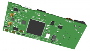
Groundradar has been working with RioTinto to develop a custom radar system for use at their Weipa bauxite operations in Australia. The ultimate system will be a real-time sampling, multi-frequency, completely wireless and waterproof radar which is designed to map both the depth of bauxite as well as the fine detail of overburden thickness and lithological variations within the bauxite. Positioning will be accomplished through the use of a RTK GPS at 20 Hz.
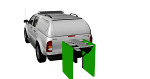
Wide band GPR antennas deployed from vehicle with real-time precise tracking
Groundradar has undertaken a new contract with the Spanish petroleum company Repsol to survey new well pads in for water migration pathways and possible karstic voids in limestone using UltraGPR technology. This contract follows from numerous successful surveys for other petroleum producers dating to 2008.
Minatura has deployed UltraGPR technology on the Sewa River in Sierra Leone to map the depth of water, the locations of dykes and gravel bars and ideally the thickness of gravel over two stretches. Groundradar has previously mapped large segments of the river with commercial radar equipment in 2003 and 2004, but this latest survey extends the coverage both up and down stream.
Groundradar’s partner in Indonesia has surveyed a nickel laterite deposit on Sulawesi Island. A widely-spaced grid was used to show the exact thickness of limonite, rocky saprolite and the depth to bedrock.
Core Geophysics, based in Perth, has conducted a laterite survey in Indonesia using UltraGPR. The ore volumes calculated from the radar data will be used to determine project feasibility and assist in mine planning. Although the terrain encountered was highly challenging for the radar team, excellent data profiles were acquired. UltraGPR has now been used survey over 23 individual nickel laterite deposits on Sulawesi Island alone.
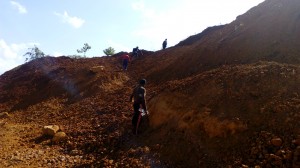
Typical lateritic terrain for which UltraGPR was designed
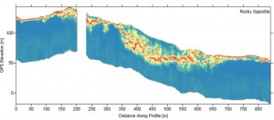
Example of UltraGPR mapping of nickel laterite showing thickness of limonite, rocky saprolite and depth to bedrock
A proof-of-concept for a limestone survey in northern Uganda using UltraGPR has been conducted by Groundradar’s South Africa-based team. The team expects to return to site shortly to conduct a full scale mapping project over a large area.

Jan Francke will be presenting a workshop on ground penetrating radar at the SAGA meeting in Drakensburg, South Africa on September 5, 2015. Details of the course:
“Although the most recent addition to the geophysicist s toolbox, Ground penetrating radar (GPR) is now a well-established geophysical method in Southern Africa. With initial developments focussing on underground and borehole applications, modern systems are now deployed daily for civil infrastructure projects throughout the region. Aside from being one of the easiest geophysical tool to employ, it is also the easiest to mis-interpret and oversell.
The concept of radar imaging of the subsurface is not new, with the principles having been wellestablished over the last century. Technological advances in GPR technology have enabled deeper and faster imaging of larger areas with higher resolution, whilst adhering to the fundamental laws of electromagnetics.
The workshop will begin by introducing the history of GPR within the context of EM theory. The workshop will focus on real-world applications of GPR in Southern Africa. Rather than only show ideal examples, the reality of GPR in the region will be discussed. Many case studies of failed surveys will be shown, along with a discussion of why a large portion of the region is often unsuitable for GPR.
Recently, claims have been made of exceptional performance by devices which seemingly are outside of the bounds of physics. These technologies will be examined and example data discussed, within the context of scientific principles”
In response to client requests, Groundradar is developing a low frequency (10 – 20 MHz) monostatic radar system using standard resistively-loaded dipole antennas. The entire length of the “snake” is expected to be less than 11 m and will incorporate UltraGPR’s latest receiver design using on-board data logging. Field trials are expected in late August, 2015.
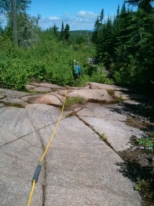
An UltraGPR system is being employed in Western Ontario to map massive sulphides. Initial results are encouraging, with mappable targets visible at depths of dozens of meters.
A next-generation UltraGPR instrument is being developed with higher stacking using 400 MHz ADC chips and a more powerful transmitter. In addition, the receiver will now contain ancillary sensors, such as a 9 degrees of freedom accelerometer, its own GPS, magnetometer, temperature and moisture sensors, and a vibration sensor, along with its own on-board datalogging capabilities on MicroSD cards. In addition, users will now be able to specify other time windows, along with time sample spacing. Of course, the new receiver will feature real-time sampling as did previous versions of UltraGPR.
