The 16th International Conference on Ground Penetrating Radar was held at the Hong Kong Polytechnic University between June 13 – 16. Dr. Francke of Groundradar presented two papers related to mapping deep paleochannels beneath thick sand cover and the use of long-range GPR for seismic static corrections. The papers were entitled “Mapping Paleochannels in the Libyan Sahara with Ground Penetrating Radar” and “The Application of Long-range GPR for Seismic Static Corrections”. The papers will be published in IEEE Xplore Conference Proceedings in August, 2016.
All posts by Groundradar
UltraGPR used in hunt for Nazi-era tunnel in Lithuania for Nova documentary
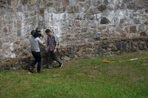
The Ponary massacre was a mass murder of as many as 100,000 people by German forces and Lithuanian Nazi collaborators during World War II. During the closing months of the war, a group of 80 prisoners from the Stutthof Concentration Camp was tasked with concealing evidence of genocide by disinterring the bodies and burning the corpses. Knowing that their own fate was extermination and kept in a deep pit each night, a group of prisoners used spoons to dig a 30 m long escape tunnel through loose sand to freedom. After the war, the location of this tunnel was lost. Using ERT and UltraGPR, Paul Bauman and Alastair McClymont from Advisian in Calgary, Canada, along with the Israel Antiquities Authority, University of Hartford, Vilna Gaon State Jewish Museum and the PBS Series NOVA located the tunnel. Further details:
http://www.theatlantic.com/news/archive/2016/06/tunnel-lithuania-nazi-death-cap/489338/
http://www.nytimes.com/2016/06/29/science/holocaust-ponar-tunnel-lithuania.html?_r=0
Photo courtesy Paul Bouman showing A. McClymont with 80 MHz UltraGPR being filmed by NOVA crew.
UltraGPR employed in search for coltan deposits in Sierra Leone
AMR Gold is using deep UltraGPR technology in the search for coltan dykes in central Sierra Leone. Initial work has focussed on tracking these thin dykes using tightly-spaced lines to create a pseudo-3D model of the subsurface. The survey work is expected to expand into unexplored regions.
Surveys with long-range GPR in Guinea for high-grade bauxite mapping
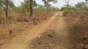
Groundradar conducted trials surveys in northern Guinea for mapping high grade ore zones within lateritic bauxite deposits. The trials were successful, and the data matched those acquired at similar bauxite deposits in SE Asia, Australia, Brazil and Madagascar.
Groundradar at PDAC booth 702
For the tenth year in a row, Groundradar is attending the PDAC show in Toronto, Canada at booth 702. Stop by for the latest news in cutting edge long-range GPR instruments and applications.
Groundradar at Mining Indaba ’16, Cape Town
Dr. Francke of Groundradar will be part of the Canadian Pavilion at the Mining Indaba show in Cape Town, South Africa, between Feb 8 – 11. Groundradar will be meeting with African users of UltraGPR and will have on display the latest GPR technology for the mining industry.

Groundradar at Exploration Roundup ‘16
Groundradar will be at the Exploration Roundup in Vancouver, Canada, from Wednesday, January 27th until Thursday January 28th. Visit us at the 1026 during the show to see the latest in deep GPR technology.
APEX Geoscience using UltraGPR in Niger to map paleochannels
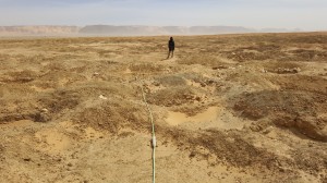
APEX Geoscience, based in Edmonton, Canada, are using UltraGPR technology in Niger to map paleochannels over desert terrain and rocky plateaux. The data thus far have been able to clearly map channels over large areas. It is expected that the team will return after the holiday season for a larger survey.
GeoEdge Jamaica commences large bauxite mapping project in Jamaica
Groundradar’s Jamaican partners have commenced a large mapping project with UltraGPR for karstic bauxite in St. Ann Parish, Jamaica. The project is expected to last at least five months and covers some 400+ hectares of ground at tight grid spacings.
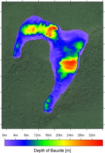
Example of karstic bauxite pit model based on UltraGPR data showing thickness of bauxite
UltraGPR used in Kenya
WorleyParsons conducted a UltraGPR survey in remote eastern Kenya to map fractures at a proposed petroleum installation. Nearly 50 km of data were surveyed on foot over three days.
